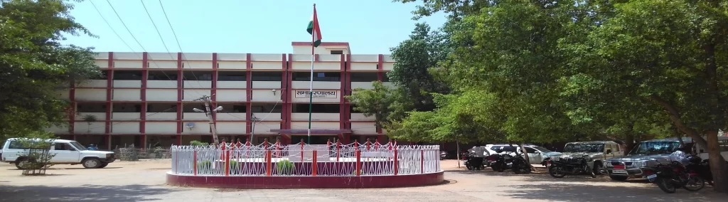
Garhwa Jharkhand: Garhwa is a city and a municipality and headquarters of the Garhwa district in the Indian state of Jharkhand. Uttar Pradesh, Chhattisgarh and Bihar are the surrounding states. Garhwa Road is a major railway junction where thousands of commuters find this station most convenient to catch their trains to Delhi and Kolkata.
In Hindi: गढ़वा भारतीय राज्य झारखंड में एक शहर और एक नगर पालिका और गढ़वा जिले का मुख्यालय है। उत्तर प्रदेश, छत्तीसगढ़ और बिहार आसपास के राज्य हैं। गढ़वा रोड एक प्रमुख रेलवे जंक्शन है जहां हजारों यात्रियों को दिल्ली और कोलकाता के लिए अपनी ट्रेन पकड़ने के लिए यह स्टेशन सबसे सुविधाजनक लगता है।
About the District
Earlier Garhwa district consisting of 8 blocks of Palamu district was separated from Palamu district as an independent district “Garhwa” from 1 April 1991. It is situated on the southwest corner of Palamu Division, which lies between 23060′ and 24039′ N latitude and 83022′ and 84000′ E longitude. The district is bounded on the north by the Son River; Palamu district and the region of Chhattisgarh in the south; Palamu District in the east; and Sonbhadra district of Uttar Pradesh and Surguja district of Chhattisgarh in the west. Garhwa District is a part of Palamu Commissionerate consisting of 20 blocks and three subdivisions namely Garhwa, Ranka and Nagar-Untari. At the time of the formation of the new district Garhwa, there were eight old blocks here.
इससे पहले पलामू जिले के 8 ब्लॉकों से युक्त गढ़वा जिले को 1 अप्रैल 1991 से एक स्वतंत्र जिले “गढ़वा” के रूप में पलामू जिले से अलग किया गया था। यह पलामू डिवीजन के दक्षिण-पश्चिम कोने पर स्थित है, जो 23060′ और 24039′ एन अक्षांश और 83022 के बीच स्थित है। ‘ और 84000’ ई देशांतर। जिला उत्तर में सोन नदी से घिरा है; पलामू जिला और दक्षिण में छत्तीसगढ़ का क्षेत्र; पूर्व में पलामू जिला; और पश्चिम में उत्तर प्रदेश का सोनभद्र जिला और छत्तीसगढ़ का सरगुजा जिला। गढ़वा जिला पलामू आयुक्तालय का एक हिस्सा है जिसमें 20 ब्लॉक और तीन अनुमंडल गढ़वा, रंका और नगर-उंटारी शामिल हैं। नए जिला गढ़वा के गठन के समय यहां आठ पुराने ब्लॉक थे।
When did the Garhwa district become?
Before coming into existence as an independent district, this district used to be a subdivision of the Palamu district. On 1 April 1991, it was separated from Palamu district and made an independent district.
The geographical location of the Garhwa district
Boundary
This district shares its border with Uttar Pradesh, Bihar and Chhattisgarh.
- In the north – the Rohtas and Kaimur districts of Bihar
- In the south – Surguja district of Chhattisgarh
- East – Palamu District and Latehar District
- In the west – the Sonbhadra district of Uttar Pradesh and the Surguja district of Chhattisgarh
Also, Read- Dahar App Jharkhand, Download और Login कैसे करे? फायदे क्या हैं?… Read More
Height above sea level :
- This district is situated at an average height of about 1200 feet above sea level.
- Area: The geographical area of this district is 4093 square kilometres.
- Major rivers: Koel, Son, Danro, Sarasatiya, Anraj, Tehale and Urea.
- Koel river forms the eastern boundary of this district. Son river forms the northern boundary of the Garhwa district.
- Economy- Agriculture, Industry and Products
- The economy of the district is based on agriculture, forest, minerals, industry and business.
- Agriculture: The economy of this district is mainly based on agriculture. The major crops grown in the district are paddy, maize, wheat, pulses (Arhar, urad, moong and gram), oilseeds (mustard, sunflower and groundnut), sugarcane and vegetables.
- Forest: This district is rich in forests. A large part of the district is covered with forests. The major forest products of Garhwa district are Khair, Sal, Mahua, Semal, Shisham, Lac, Kendu, Salai, etc.
- Minerals: The major minerals found in this district are: Dolomite, Limestone Graphite, China Clay and Granite.
- Industry: This district is rich in minerals. Dolomite and limestone are mined here.
Administrative Setup of Garhwa District
- Division: Palamu: For administrative convenience, this district has been divided into 3 subdivisions and 20 blocks.
- Subdivision: The district is divided into three sub-divisions: Garhwa, Ranka and Shri Banshidhar Nagar (Nagar Untari).
- Block: This district is divided into a total of 20 blocks:
Garhwa, Mazianv, Bardiha, Kandi, Ketar, Danda, Kharondhi Bhavnathpur, Nagar Untari, Bishunpura, Meral, Ramna, Sagama, Dhurki, Dandai, Chiniya, Ranka, Ramkanda, Bargarh and Bhandariya. - Number of Police Stations: 21
- A number of Municipal bodies: 3, Garhwa, Majhianv and Sinduria.
Number of Gram Panchayats: 189
Total No. of Villages: 915 - Constituency
Lok Sabha: Palamu Lok Sabha Constituency. The entire Garhwa district and part of Palamu district come under this constituency. - Assembly: A total of 2 assembly constituencies come under this district: Garhwa and Bhavnathpur.
Demographics of Garhwa District
- According to the official census of 2011, the demographics of this district are as follows-
- Total population: 13.23 lakh
- Male: 6.83 Lakh
- Female: 6.39 Lakh
- Population growth (decadal): 27.75%
- Population Density (per sq km): 323
- Proportion to the population of Jharkhand: 4.01%
- Sex Ratio (Females per 1000 Males): 935
- Average Literacy: 60.33%
- Male Literacy: 72.19%
- Female Literacy: 47.58%
- Urban and rural population
- Urban Population: 5.27%
- Rural Population: 94.73%
Also, Read- Jharkhand Bhu Naksha, Purpose, Features of Jharkhand Land Map, How to See & Print Your Bhu Naksha… Read More
The religion of Garhwa District
According to the official census of 2011, it is a Hindu-majority district. The population of Hindus in the district is 83.50%, while the population of Muslims is 14.72%. Talking about other religions, Christians are 1.30%, Sikhs 0.01%, Buddhists 0.03% and others 0.35% in the district.
Attractions in Garhwa District
Radha Krishna Temple: This famous temple dedicated to Lord Krishna is situated in Nagar Untari.
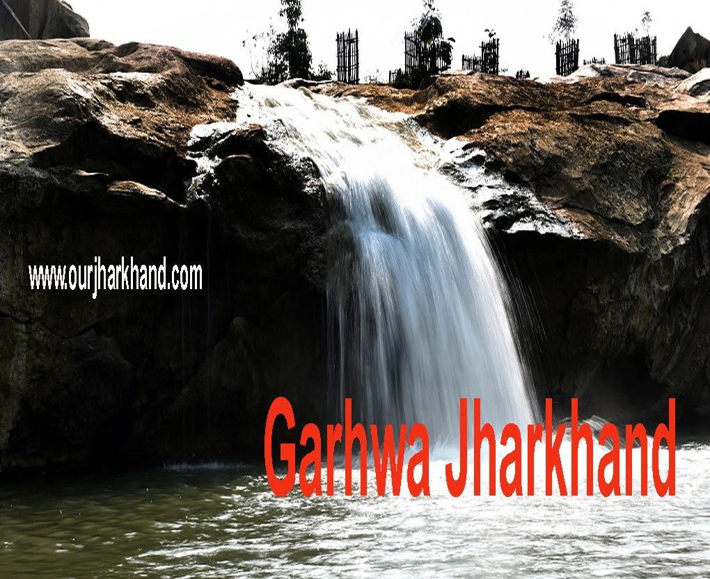
Sukhaldari Falls: This beautiful waterfall is a popular tourist spot in the district. The waterfall is located on the banks of the Kanhar river in Dhurki block, about 50 kilometres from Garhwa district headquarters.
How to reach Garhwa?
- By Air: This district does not have its own airport. Direct air facilities are not available for hire.
- Nearest Airport: Lal Bahadur Shastri Airport, Varanasi (Code: VNS).
- This airport is located in Varanasi, Uttar Pradesh at a distance of about 241 km from Garhwa.
- By Rail: You can easily reach here by rail. This district is connected by rail to the cities of Jharkhand as well as other parts of the country. A regular train facility is available for hire.
- Nearest Railway Station: Garhwa Railway Station (Code: GHQ).
- By Road: The district is well connected to major cities of Jharkhand state and country through a network of roads. National Highway 39 and National Highway 343 pass through the Garhwa district. You can also come here by your personal vehicle car or bike.
Some interesting things about Garhwa district:
- It is the 10th largest district of Jharkhand in terms of population.
- It is the 7th largest district of Jharkhand in terms of area.
- Jharkhand ranks 16th in terms of population density.
- Jharkhand ranks 19th in terms of sex ratio.
- Arsali, which comes under Bhavnathpur block, is the largest populated village in the Garhwa district.
- Block with most villages: Garhwa (122)
- Block with the least number of villages: Danda (7)
- Area wise largest village of the district:
- Madgari Kalan, a village under Bhandaria block (Area – about 4214.59 hectares).
- Smallest village in the district in terms of area:
- Naubhilma (Area – 3 Hectares)
गढ़वा जिले के बारे में कुछ रोचक बातें:
- जनसंख्या की दृष्टि से यह झारखंड का 10वां सबसे बड़ा जिला है।
- क्षेत्रफल की दृष्टि से यह झारखंड का 7वां सबसे बड़ा जिला है।
- जनसंख्या घनत्व के मामले में झारखंड 16वें स्थान पर है।
- लिंगानुपात के मामले में झारखंड 19वें स्थान पर है।
- अरसाली, जो भवनाथपुर ब्लॉक के अंतर्गत आता है, गढ़वा जिले का सबसे बड़ा आबादी वाला गाँव है।
- अधिकांश गांवों वाला ब्लॉक: गढ़वा (122)
- सबसे कम गांवों वाला प्रखंड : डांडा (7)
- क्षेत्रवार जिले का सबसे बड़ा गांव
- मडगरी कलां, भण्डारिया प्रखंड के अंतर्गत आने वाला गाँव (क्षेत्रफल – लगभग 4214.59 हेक्टेयर)।
- क्षेत्रफल की दृष्टि से जिले का सबसे छोटा गाँव
- नौभिल्मा (क्षेत्र – 3 हेक्टेयर)
River System
The general line of drainage is from south to north towards Koel and Son rivers. Koel forms the eastern boundary and Son forms the northern boundary of the district. There are also a number of smaller streams, most of them from mountain streams with rock stream beds. Other important rivers of the district are Danro, Sarasatiya, Tehale, Annaraj, Uriya, Bai Banki, Belaiti, Pando, Birha and Sapahi. The other notable river is the Kanhar which forms the southeastern boundary of the district for about 80 KM. Due to its geographical structure, the Garhwa district is rich in water resources.
Climate Conditions
The climate of this district is on the whole dry and tolerable. The year can divides into three main seasons, the winter season from November to March, the summer season from March to May and the monsoon season from June to September; October is a transitional month between the monsoon and winter seasons. The average annual rainfall for the entire district is 1.335 mm / 52.55 in. From the onset of the monsoon till mid-June, rainfall rapidly increases to peak levels in August. The annual variation of rainfall is not much. December and January are the coldest months. There is a steady rise in temperature till March. The maximum temperature in May and early June can reach up to 470C on individual days. The humidity is generally normal in this district, except in the monsoon months.
इस जिले की जलवायु कुल मिलाकर शुष्क और सहनीय है। वर्ष को तीन मुख्य ऋतुओं में विभाजित किया जा सकता है, शीत ऋतु नवम्बर से मार्च तक, ग्रीष्म ऋतु मार्च से मई तक और मानसून ऋतु जून से सितम्बर तक; अक्टूबर मानसून और सर्दियों के मौसम के बीच एक संक्रमणकालीन महीना है। पूरे जिले के लिए औसत वार्षिक वर्षा 1.335 मिमी / 52.55 इंच है। मानसून की शुरुआत से जून के मध्य तक, अगस्त में वर्षा तेजी से चरम स्तर तक बढ़ जाती है। वर्षा की वार्षिक भिन्नता अधिक नहीं है। दिसंबर और जनवरी सबसे ठंडे महीने हैं। मार्च तक तापमान में लगातार वृद्धि होती रहती है। मई और जून की शुरुआत में अधिकतम तापमान अलग-अलग दिनों में 470C तक पहुंच सकता है। मानसून के महीनों को छोड़कर, इस जिले में आम तौर पर आर्द्रता सामान्य है।
Also, Read- Bhulekh Jharkhand, Highlights of Jharbhumi, How to Che…Read More.
Land Use and Crops
Garhwa partially falls under the rain shadow region and suffers from frequent droughts. Although the annual average rainfall is sufficient for agricultural purposes, the uneven distribution of seasonal rainfall affects the main crops badly. The water table in the district goes down during the summer season and a large number of villages face water scarcity. Due to drought, a section of agricultural labourers migrates to the nearest district of another state every year for employment and livelihood.
But due to the development works of the government. and minor and major irrigation works. Agricultural works have developed to a great extent in recent years. Rice is the staple food of the district and is mainly grown in it. Maize and wheat are other notable crops. Sugarcane, oilseeds, pulses and vegetables are also grown in the district, seed collection of sal, Mahua, Semal and other forest produce like lac, Kendu leaves etc is also part of income for some periods, and it has 35730.50 hectares of agricultural land. District. The approximate per capita land holding is 0.17 hectares.
Demographic Profile of Garhwa Jharkhand
Garhwa District is predominantly rural and most of the population lives in villages. The tribal population of the district still lives in the forest tract. Due to the rural economy based on agriculture, the pace of urbanization has been very slow. As per the 1991 census, the total population of the district was 801239. The population of the district has recorded as 1034151 in the 2001 census. In the 2001 census, the rural population records as 991492 against the urban population of 42659. In urban population, Garhwa municipality has recorded 36708.
And in Sinduria City (Bhavnathpur) 5951 souls have records. From the last census 1991 to the present census 2001, the rate of urban growth in this district has been 53.72 per cent. Which is second in the state of Jharkhand after Godda district. The percentage of decadal growth (1991-2001) of the Garhwa district is 29.05, which is the highest in the state of Jharkhand. Out of the total population of the district, Scheduled Castes comprise 26.32% and Scheduled Tribes comprise 19.91%.
Like other districts of Jharkhand, Garhwa also has an unfavourable sex ratio for females. The sex ratio of Garhwa is 935:1000. There are 938 females per 1000 males in rural areas and 864 females per 1000 males in urban areas.
Suggested Link:- www.digitalindiagov.in
@Ron