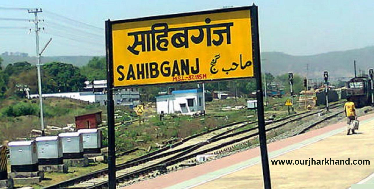
Sahibganj Jharkhand: Sahibganj district ranks thirteenth in terms of the total population in the state and thirteenth in respect of decadal population growth rate (2001–11) out of twenty-four districts. With a sex ratio of 952, it ranks fifteenth in the state. The district comprises nine blocks, namely Sahibganj, Mandro, Borio, Barhait, Taljhari, Rajmahal, Udhwa, Pathna and Barharwa. As per the 2011 census, the district has 1349 villages and 8 towns distributed over three assembly constituencies. The Census 2011 data indicated that the percentage share of the Scheduled Caste population to the total population was 6.29 per cent while that of Scheduled Tribes was 26.80 per cent. The percentage of BPL households in rural areas is 86.03 per cent based on the total number of rural households in the 2011 census and the BPL revision survey of 2010-11.
In Hindi:
साहिबगंज जिला चौबीस जिलों में से राज्य में कुल जनसंख्या के मामले में तेरहवें और दशकीय जनसंख्या वृद्धि दर (2001-11) के मामले में तेरहवें स्थान पर है। 952 के लिंगानुपात के साथ, यह राज्य में पंद्रहवें स्थान पर है। जिले में नौ ब्लॉक शामिल हैं, जिनके नाम साहिबगंज, मांडरो, बोरियो, बरहेट, तालझारी, राजमहल, उधवा, पथना और बरहरवा हैं। 2011 की जनगणना के अनुसार, जिले में 1349 गांव और 8 कस्बों को तीन विधानसभा क्षेत्रों में बांटा गया है। जनगणना 2011 के आंकड़ों ने संकेत दिया कि कुल जनसंख्या में अनुसूचित जाति की आबादी का प्रतिशत हिस्सा 6.29 प्रतिशत था जबकि अनुसूचित जनजाति का प्रतिशत 26.80 प्रतिशत था। 2011 की जनगणना और 2010-11 के बीपीएल संशोधन सर्वेक्षण में ग्रामीण परिवारों की कुल संख्या के आधार पर ग्रामीण क्षेत्रों में बीपीएल परिवारों का प्रतिशत 86.03 प्रतिशत है।
About Sahibganj
Sahibganj district is a district in the Jharkhand state of India. The total area of Sahibganj is 2,063 km², which includes 2,035.78 km² rural area and 27.22 km² urban area. As of 2011, Sahibganj has a population of 11,50,567, of which the urban population is 1,59,666 while the rural population is 9,90,901. The population density of the district is 557.7 inhabitants per square kilometre. There are about 2,27,023 households in the district, including 30,967 urban households and 1,96,056 rural households. Talking villages, there are about 1,349 villages in the Sahibganj district.
Sahibganj District is further divided into Subdivision/Block/PS/Community Development Block (C.D.Block) for administrative purposes. In India, Block or CD Block is often the next level of the administrative division after Tehsil. It is important to note that, in some states of India, C.D. Blocks are equivalent to Tehsils.
For those who do not know, C.D.Block is a rural area earmarked for administration and development in India. The area is administered by a BDO (Block Development Officer). A C.D.Block comprises a number of Gram Panchayats, the local administrative units at the village level.
Borio is the largest subdivision in Sahibganj district with an area of 367.20 km² while Udhwa is the smallest subdivision in Sahibganj district with an area of 92.04 km². Barharwa is the most populous subdivision while Mandro is the least populous subdivision in the Sahibganj district. There are 9 subdivisions in the Sahibganj district. Here is the list of all Sahibganj Subdivision / Block / CD Block with their area and population information.
In Hindi:
साहिबगंज जिला भारत के झारखंड राज्य का एक जिला है। साहिबगंज का कुल क्षेत्रफल 2,063 वर्ग किमी है, जिसमें 2,035.78 वर्ग किमी ग्रामीण क्षेत्र और 27.22 वर्ग किमी शहरी क्षेत्र शामिल है। 2011 तक, साहिबगंज की जनसंख्या 11,50,567 है, जिसमें शहरी आबादी 1,59,666 है जबकि ग्रामीण आबादी 9,90,901 है। जिले का जनसंख्या घनत्व 557.7 निवासी प्रति वर्ग किलोमीटर है। जिले में लगभग 2,27,023 परिवार हैं, जिनमें 30,967 शहरी परिवार और 1,96,056 ग्रामीण परिवार शामिल हैं। गांवों की बात करें तो साहिबगंज जिले में करीब 1349 गांव हैं।
साहिबगंज जिले को प्रशासनिक उद्देश्यों के लिए अनुमंडल/ब्लॉक/पीएस/सामुदायिक विकास खंड (सी.डी.ब्लॉक) में विभाजित किया गया है। भारत में, तहसील के बाद ब्लॉक या सीडी ब्लॉक अक्सर प्रशासनिक प्रभाग का अगला स्तर होता है। यह ध्यान रखना महत्वपूर्ण है कि, भारत के कुछ राज्यों में, सी.डी. ब्लॉक तहसील के बराबर हैं।
जो लोग नहीं जानते हैं, उनके लिए C.D.Block भारत में प्रशासन और विकास के लिए निर्धारित एक ग्रामीण क्षेत्र है। क्षेत्र एक बीडीओ (खंड विकास अधिकारी) द्वारा प्रशासित है। एक सीडी ब्लॉक में कई ग्राम पंचायतें शामिल हैं, जो ग्राम स्तर पर स्थानीय प्रशासनिक इकाइयाँ हैं।
बोरियो 367.20 वर्ग किमी के क्षेत्रफल के साथ साहिबगंज जिले का सबसे बड़ा अनुमंडल है, जबकि उधवा 92.04 वर्ग किमी क्षेत्रफल के साथ साहिबगंज जिले का सबसे छोटा अनुमंडल है। बरहरवा सबसे अधिक आबादी वाला अनुमंडल है जबकि मांडरो साहिबगंज जिले में सबसे कम आबादी वाला अनुमंडल है। साहिबगंज जिले में 9 अनुमंडल हैं। यहां सभी साहिबगंज अनुमंडल / ब्लॉक / सीडी ब्लॉक की सूची उनके क्षेत्र और जनसंख्या की जानकारी के साथ दी गई है।

List of CD Blocks / Subdivisions in Sahibganj District
| Subdivision (CD Block) | Area (km²) | Population (2011) |
| Barhait | 352 | 1,30,227 |
| Barharwa | 179 | 1,80,770 |
| Borio | 367 | 97,845 |
| Mandro | 217 | 75,659 |
| Pathna | 176 | 81,940 |
| Rajmahal | 245 | 1,68,413 |
| Sahibganj | 180 | 1,62,120 |
| Taljhari | 255 | 76,330 |
| Udhwa | 92 | 1,77,263 |
Geographical Details of District
| Name | Description |
| Longitude | 87025′ East to 87054′ East |
| Latitude | 24042′ North to 25021′ North |
| Height from sea level | 1702.10 sq. Kms. |
| Total Area | 1702.10 Sq. Kms. |
Geographical Situation
Sahibganj District is situated approximately between 24042′ North and 25021′ North latitude and 87025′ and 87054′ East longitude. Sahibganj is the administrative headquarters of the district and is situated on the banks of river Ganga at 25015′ north latitude and 87038′ east longitude. The geographical area of the district is 1599.00 Sq.Km. Is.
It is bounded by the Ganges River and Katihar district to the north, Godda district to the south, Malda and Murshidabad districts of West Bengal state to the east, and Bhagalpur and Godda districts to the west.
भौगोलिक स्थिति: Sahibganj Jharkhand
साहिबगंज जिला लगभग 24042′ उत्तर और 25021′ उत्तरी अक्षांश और 87025′ और 87054′ पूर्वी देशांतर के बीच स्थित है। साहिबगंज जिले का प्रशासनिक मुख्यालय है और 25015′ उत्तरी अक्षांश और 87038′ पूर्वी देशांतर पर गंगा नदी के तट पर स्थित है। जिले का भौगोलिक क्षेत्रफल 1599.00 वर्ग किमी है। है।
यह उत्तर में गंगा नदी और कटिहार जिले, दक्षिण में गोड्डा जिले, पूर्व में पश्चिम बंगाल राज्य के मालदा और मुर्शिदाबाद जिलों और पश्चिम में भागलपुर और गोड्डा जिलों से घिरा है।
Physical Aspect:-
A major part of the district is hilly. The vast tract of land sandwiched between the hill ranges was given the name – Damin-i-Koh, which is a Persian word meaning skirt of hills. The area along the banks of the Ganges is fertile and extensively cultivated.
The district can be divided into two natural divisions on the basis of its geographical location and cultivable land.
The first zone includes Borio, Mandro, Barhait, Pathna and Taljhari blocks and comes under the Damin-e-Koh region. The hills and slopes are covered with forests, which were once dense but are now sparse. The valleys have cultivable land, which produces mostly paddy. The inhabitants of this region are generally Paharias, Mal Paharias and Santhals. The residents living on the top of the hill cultivate Barbatti and Maize using rainwater.
The second zone includes Sahibganj, Rajmahal, Udhwa and Barharwa blocks. This plain region consists of highlands, ridges as well as undulating areas and depressions. The Ganges, Gumani and Bansloi rivers flow through this region. The region has very fertile land and is extensively cultivated. The residents of this area are mainly middle-class people of various castes, Paharias and Santhals.
भौतिक स्वरूप:- Sahibganj Jharkhand
जिले का एक बड़ा हिस्सा पहाड़ी है। पहाड़ी श्रृंखलाओं के बीच स्थित भूमि के विशाल पथ को दामिन-ए-कोह नाम दिया गया था, जो एक फारसी शब्द है जिसका अर्थ है पहाड़ियों की स्कर्ट। गंगा के किनारे का क्षेत्र उपजाऊ है और बड़े पैमाने पर खेती की जाती है।
जिले को उसकी भौगोलिक स्थिति और खेती योग्य भूमि के आधार पर दो प्राकृतिक प्रभागों में विभाजित किया जा सकता है।
पहले जोन में बोरियो, मांडरो, बरहेट, पथना और तलझरी ब्लॉक शामिल हैं और यह दामिन-ए-कोह क्षेत्र के अंतर्गत आता है। पहाड़ियाँ और ढलान जंगलों से आच्छादित हैं, जो कभी घने थे लेकिन अब विरल हैं। घाटियों में खेती योग्य भूमि है, जो ज्यादातर धान का उत्पादन करती है। इस क्षेत्र के निवासी सामान्यतः पहाड़िया, माल पहाड़िया और संथाल हैं। पहाड़ी की चोटी पर रहने वाले निवासी वर्षा जल का उपयोग करके बरबट्टी और मक्का की खेती करते हैं।
दूसरे जोन में साहिबगंज, राजमहल, उधवा और बरहरवा प्रखंड शामिल हैं. इस मैदानी क्षेत्र में हाइलैंड्स, रिज के साथ-साथ लहरदार क्षेत्र और अवसाद शामिल हैं। गंगा, गुमानी और बांसलोई नदियाँ इस क्षेत्र से होकर बहती हैं। इस क्षेत्र में बहुत उपजाऊ भूमि है और बड़े पैमाने पर खेती की जाती है। इस क्षेत्र के निवासी मुख्य रूप से विभिन्न जातियों, पहाड़िया और संथाल के मध्यम वर्ग के लोग हैं।
Rivers:-
The river Ganges forming the northern boundary of the district enters its north-western corner and flows east till Sakrigali where it turns south and forms the southern boundary of the district a little beyond Radhanagar in the Rajmahal subdivision. The river is slowly flowing north and the town of Sahibganj, which was once on the banks of the river, is now about a mile away. The average width of the Ganges in the district is about four and a half kilometres. It usually swells during rains and submerges the low-lying areas east of the railway loop line. There are ferry services across the river between Sahibganj Ghat in Sahibganj district on one side and Manihari Ghat in Katihar district on the other and Rajmahal Ghat in Sahibganj district and Manikchak Ghat in Maldah district of West Bengal. Country boats also ply in the river.
The Gumani River originates from the southern region of the Rajmahal Hills. It flows in a northeast direction till the Barhet Valley where it joins the Mural River. The combined stream takes a south-easterly turn and joins the Ganges a short distance from the district boundary.
नदियाँ:- Sahibganj Jharkhand
जिले की उत्तरी सीमा बनाने वाली गंगा नदी इसके उत्तर-पश्चिमी कोने में प्रवेश करती है और पूर्व में सक्रीगली तक बहती है जहाँ यह दक्षिण की ओर मुड़ जाती है और राजमहल उपखंड में राधानगर से थोड़ा आगे जिले की दक्षिणी सीमा बनाती है। नदी धीरे-धीरे उत्तर की ओर बह रही है और साहिबगंज शहर, जो कभी नदी के किनारे था, अब लगभग एक मील दूर है। जिले में गंगा की औसत चौड़ाई लगभग साढ़े चार किलोमीटर है। यह आमतौर पर बारिश के दौरान सूज जाता है और रेलवे लूप लाइन के पूर्व में निचले इलाकों को जलमग्न कर देता है। एक तरफ साहिबगंज जिले के साहिबगंज घाट और दूसरी तरफ कटिहार जिले के मनिहारी घाट और साहिबगंज जिले के राजमहल घाट और पश्चिम बंगाल के मालदह जिले के माणिकचक घाट के बीच नदी के पार नौका सेवाएं हैं। देशी नावें भी नदी में चलती हैं।
गुमानी नदी राजमहल पहाड़ियों के दक्षिणी क्षेत्र से निकलती है। यह बरहेट घाटी तक उत्तर-पूर्व दिशा में बहती है जहाँ यह मुरल नदी में मिल जाती है। संयुक्त धारा दक्षिण-पूर्व की ओर मुड़ती है और गंगा में जिले की सीमा से थोड़ी दूरी पर मिलती है।v
Forest:- Sahibganj Jharkhand
The region, once known for its dense and extensive forests, is now devoid of much of its forest wealth due to rampant unscrupulous logging. The Forest Department has planted saplings in these areas.
The most common tree found in the district is Sal (Shorea robusta). Some teak, though not of good quality, is also found. Some other trees found in the district are jackfruit, murga, simal, bamboo, Asan and Satsal. Sal and Simal log and jackfruit are exported in large quantities to neighbouring districts and places outside Jharkhand.
Livestock:- Sahibganj Jharkhand
Despite the large population of cattle, the milk yield in the district is very low. Artificial insemination centres and sub-centres have been opened at various places in the district for grading animals quickly and at a low cost.
Fisheries:- Sahibganj Jharkhand
The broad bed of the Ganges at Sahibganj and Rajmahal provides one of the best areas in the state for fish rearing and fishing. Rohu, Katla, Mirga, Catfish and Hilsa eggs are collected from Barhet Valley.
Mines and Minerals:- Sahibganj Jharkhand
The Rajmahal Hills are the source of buildings and road stones. Most of the excavation is done along the loop line of the Eastern Railway. Pakur chips are quite famous and are used extensively throughout Jharkhand, Bihar and parts of West Bengal. Kaolin is found near Mangal Haat in the Rajmahal subdivision. Elsewhere available bentonite is used by women as a hair wash and nowadays it is becoming popular among urban women in the form of Multani Mitti.
Suggested Link:- www.digitalindiagov.in
@Ron