Weather Bokaro Steel City Jharkhand: This district of Bokaro was carved out on 1st April 1991 from Chas and Chandankiyari C.D.s of the Dhanbad district. The block and the entire Bermo subdivision of Giridih district were carved out to form a new district. Bokaro district is bounded by Dhanbad district and parts of West Bengal state to the east, Ramgarh district to the west, Purulia district of West Bengal to the south and Giridih, Hazaribagh and parts of Dhanbad districts to the north. The district extends between 23o26” to 23o57” north latitude and 85o34” to 86o26” east latitude. The district is situated at an altitude of 200-546 metres. above mean sea level.
The Settlement Report for Manbhum, 1928 and the District Gazetteer for Dhanbad, 1964 are the sources available to trace some of the historical backgrounds of the newly created district of Bokaro. As the matter of fact is that not much information is available about the Bokaro district in particular. Dhanbad district was created on 24.10.1956 on the recommendation of the State Reorganization Commission. The erstwhile district of Dhanbad consisted of two subdivisions, Dhanbad Sadar and Baghmara. On 01.04.1991 Baghmara Sub-Division, formerly known as Chas Sub-Division, became an integral part of Bokaro District.
In Hindi:
बोकारो का यह जिला 1 अप्रैल 1991 को धनबाद जिले के चास और चंदनकियारी सी.डी. से अलग किया गया था। गिरिडीह जिले के ब्लॉक और पूरे बेरमो उपखंड को एक नया जिला बनाने के लिए तराशा गया था। बोकारो जिला धनबाद जिले और पूर्व में पश्चिम बंगाल राज्य के कुछ हिस्सों, पश्चिम में रामगढ़ जिले, दक्षिण में पश्चिम बंगाल के पुरुलिया जिले और उत्तर में गिरिडीह, हजारीबाग और धनबाद जिलों के कुछ हिस्सों से घिरा है। जिला 23o26” से 23o57” उत्तरी अक्षांश और 85o34” से 86o26” पूर्वी अक्षांश के बीच फैला हुआ है।
जिला 200-546 मीटर की ऊंचाई पर स्थित है। औसत समुद्र तल से ऊपर। मानभूम, 1928 के लिए बंदोबस्त रिपोर्ट और धनबाद के लिए जिला गजेटियर, 1964 बोकारो के नव निर्मित जिले की कुछ ऐतिहासिक पृष्ठभूमि का पता लगाने के लिए उपलब्ध स्रोत हैं। खास बात यह है कि विशेष रूप से बोकारो जिले के बारे में ज्यादा जानकारी उपलब्ध नहीं है। धनबाद जिला राज्य पुनर्गठन आयोग की सिफारिश पर 24.10.1956 को बनाया गया था। धनबाद के पूर्ववर्ती जिले में दो अनुमंडल शामिल थे, धनबाद सदर और बाघमारा। 01.04.1991 को बाघमारा अनुमंडल, जिसे पहले चास अनुमंडल के नाम से जाना जाता था, बोकारो जिले का एक अभिन्न अंग बन गया।
Early History
It is difficult to trace the early history of large parts of the region, as the present district of Bokaro is only a small and insignificant part of Manbhum. In the settlement report of Manbhum, it is stated that no inscriptions, no copper plates or old coins were found during the survey and settlement operations. The oldest authentic documents produced were all on paper and they are barely a hundred years old. Prior to this, Bokaro district, which was part of the Dhanbad district till the 1991 census, was in turn part of the old district of Manbhum. Manbhum derives its name from Raja Man Singh, who received the region as a gift from Emperor Akbar. Later the very vast and remote district of Manbhum divides into Birbhum, Manbhum and Singhbhum.
The area forming part of the Bokaro district was mainly inhabited by Kolar caste people. The earliest civilization in the area dates back to around 600 BC. I belonged to the Jains. Jain supremacy was overthrown by Brahmins around the 7th century CE, as is evident from Hiuen Tsang’s travelogue, which mentions a powerful kingdom ruled by Sasanka who was an oppressor of Buddhists. The brahminical civilization was at its peak in the 10th century AD and was completely destroyed thereafter by the Bhumij and Mundari tribes. During Akbar’s time, Raja Man Singh led his troops from Bhagalpur to Midnapore through the Jharkhand region and may have passed through the areas under the Bokaro district.

British Era
मानभूम का पुराना जिला (वर्तमान बोकारो जिला शामिल है) 1765 में अंग्रेजों द्वारा अधिग्रहित किया गया था। ब्रिटिश काल के दौरान सैन्य अभियानों की एक श्रृंखला ने छोटे जमींदारों को नियंत्रण में ला दिया। इसके अलावा, 1796 में क्षेत्र में एक स्थायी बंदोबस्त किया गया था। 1805 में बांकुरा में मुख्यालय के साथ एक अलग मजिस्ट्रेट चार्ज के तहत जंगल महल नाम का एक नया जिला गठित किया गया था। 1833 में जंगल महल जिले को तोड़ दिया गया और मानभूम नामक एक नया जिला बनाया गया, बाद में 1838 में, पुरुलिया को मानभूम जिले के मुख्यालय के रूप में तय किया गया। अतः वास्तव में प्रमुख औद्योगिक क्षेत्र बोकारो को महत्व प्राप्त हुआ और सरकार के निर्णय से भारत के मानचित्र पर प्रसिद्ध स्थान प्राप्त हुआ।
1960 के दशक की शुरुआत में सोवियत रूस के सहयोग से एक आधुनिक सार्वजनिक क्षेत्र का इस्पात संयंत्र स्थापित करना। यह 1966 में था कि श्रीमती। इंदिरा गांधी, दिवंगत प्रधान मंत्री ने बोकारो स्टील प्लांट के रूप में आज जो प्रसिद्ध है, उसकी आधारशिला रखी। चंदनकियारी क्षेत्र में ओएनजीसी द्वारा मीथेन गैस के एक विशाल स्रोत की पहचान के साथ 1990 के दशक की शुरुआत में एक नया क्षितिज खुल गया। इसने बताया कि ओएनजीसी इस क्षेत्र में एक विशाल गैस संयंत्र स्थापित करने की योजना बना रहा है, जो वर्तमान बोकारो इस्पात संयंत्र की तुलना में आकार और महत्व में बड़ा होगा।
Also, Read- Also, Read- Dhanbad Jharkhand, Environment, Socioeconomics, Populations, Religion, Economy, Transport… Read More
Physical Features & Weather
The district spread between 23o26”-23o57” north latitude and 85o34”-86o26” east latitude. Bokaro Uplands (in the western part), Bokaro-Chas Uplands (central part), and Damodar-Barakar Basin (eastern part) are the physical divisions in which Bokaro-Chas Uplands is the major physical division of the district. This area forms the southwestern part of the district. It extends from north to south. The Damodar River forms its northern boundary. The region bind by the state of West Bengal in the south, the Damodar-Barakar basin in the east and the Giridih district in the west. It contains the major part of Chaas and a small part of Chandankiyari CD. block.
The entire area has an undulating surface. The altitude varies between 200 m to 282 m. The general slope of the region is from west to east. Damodar is the main river that flows in this tract along with tributaries like Garga and Parga. The small rivers flowing in the district are Bokaro, Kunar, Khusa and Uri. So the other river in the district is Gobi, which flows through Konar in the Chandankiyari block area and Gomia block. Scattered patches of forest find throughout the region. Also, its geology is related to the Chotanagpur Nice. The soil is Ustalfs-Aqualfs-Ochrepts.
The average annual rainfall is 1,291.2 mm. Paddy, millets and pulses are the main crops of this region. The district is situated at an altitude of 200-546 metres. above mean sea level. The highest peaks are Dhamdharwatoli (740 m), Lugu Pahar (1070 m), Chainpur (700 m), and Bhaski (793 m). All these peaks find in the western part of the district. Rugged topography finds in the western part of the district. The major part of the district consists of Chotanagpur gneisses and small patches of Gondwana formations with thick layers of coal.
Land Use Pattern
The land of the district mostly single-cropped and rain-fed. The district is mostly covered with hills and forests. The soil is generally laterite and sandy. On the other hand, only 39.21% of the total area of the district is currently under agriculture and about 9.09% of the cultivable land is under the horticulture sector.
Also, Read- Bhulekh Jharkhand, Highlights of Jharbhumi, How to Che…Read More.
Main Crops
Rice and maize are the main agricultural crops while millets, wheat, pulses and vegetables are other crops grow here. Also, a marginal part of non-forest, G.M. The land and tenant land are under horticulture and social forestry.
Mines and Minerals
The Bermo-Phusro coalfield lies entirely in this district and is rich in coal. Stones and stone boulders are a part of other coal minerals for extraction. Stone chips produce.
Irrigation
चूंकि जिले की स्थलाकृति पहाड़ी है, इसलिए सतही जल के दोहन की ज्यादा गुंजाइश नहीं है। सिंचाई के अन्य साधन भूगर्भ जल का दोहन और सिंचाई के लिए संसाधन लेना बचा है। जिले में टैंक सिंचाई काफी लोकप्रिय है। आजादी के बाद डी.वी.सी. स्थानीय आबादी की स्थिति और उनकी सिंचाई आवश्यकताओं में सुधार के लिए हाल के दिनों में जिला अधिकारियों द्वारा कई योजनाएं स्थापित की गईं और कई मध्यम नदी सिंचाई योजनाएं जैसे खुले बोरिंग, नलकूप और हैंडपंप स्थापित किए गए।
Forest, Flora and Fauna
बेरमो अनुमंडल में, जिला वन संपदा में अपेक्षाकृत समृद्ध है। सीडी। जिन ब्लॉकों में जवाबदेह वन संपदा है, वे हैं नवाडीह, पीटरवार, कसमार, गोमिया और चंदनकियारी। जंगल साल (सखुआ) के पेड़ों से भरे हुए हैं। इस क्षेत्र में पाए जाने वाले अन्य पेड़ आम, सीसुम, केंदू, कटहल आदि हैं। इस क्षेत्र में किसी भी जंगली जानवर के पाए जाने की सूचना नहीं है। पालतू पशुओं में गाय, भैंस, बकरी, सूअर आदि हैं।
Also, Read- MGNREGA Jharkhand, How to Check Job Card List, Local…Read More.
FAQs on Weather Bokaro Steel City Jharkhand
What is the famous food of Bokaro?
Some of the important dishes include Litti Chokha, Macher Jhol (fish curry), sadhana and marua roti.
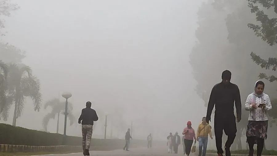
What is the climate of Bokaro?
The average maximum temperature is around 37°C. Monsoons observe in Bokaro from June to September. The city receives heavy rainfall during the season, with an average rainfall of 1000 mm recorded. So with a monthly average rainfall of 334 mm, July is the rainiest month for the city.
Is Bokaro a good place to live?
Jamshedpur and Bokaro have always been cities of industrial importance. With time, they have emerged in the real estate market as well, and have started seeing people flocking in large numbers. Hence both of these are among the first planned cities of India. So Bokaro Steel City is the 86th largest urban agglomeration in India.
Which language spokes in Bokaro?
As of the 2011 Census of India, 46.23% of the population in the district spoke Khortha, 13.61% Hindi, 11.39% Santali, 10.67% Bengali, 5.71% Bhojpuri, 4.09% Urdu, 4.04% Magahi and 1.14% Maithili. First language.
Suggested Link:- My Business Mart
@Ron