Godda Jharkhand: Godda district is one of the twenty-four districts of Jharkhand state in eastern India. It is situated in the northeastern part of the state. The geographical area which now comprises the Godda district used to be a part of the erstwhile Santhal Parganas district. Godda city is the headquarters of the Godda district. The area of the district is 2110 km² with a population of about 1313551. Godda district is well connected by rail link. The nearest railway station is Godda. The main economic activity of the people is agriculture, and the major crops are paddy, wheat, and maize.
Godda is the land of a tribe called the Santhals. It is not just a land of tribals, the local residents also include non-tribals and urbanites. Godda is a Silk City with a municipal council in the Godda subdivision and Mahagama subdivision Godda district in the Indian state of Jharkhand. Godda town is the district headquarters of Godda.
Also, Read- Dumka Jharkhand, खनिज पदार्थ, कृषि, उद्योग, पर्यटन, Famous Places to Visit, Geographical Location… Read More
In Hindi:
गोड्डा जिला पूर्वी भारत में झारखंड राज्य के चौबीस जिलों में से एक है। यह राज्य के उत्तरपूर्वी भाग में स्थित है। भौगोलिक क्षेत्र जिसमें अब गोड्डा जिला शामिल है, पूर्व संथाल परगना जिले का एक हिस्सा हुआ करता था। गोड्डा शहर गोड्डा जिले का मुख्यालय है। लगभग 1313551 की आबादी के साथ जिले का क्षेत्रफल 2110 वर्ग किमी है। गोड्डा जिला रेल लिंक से अच्छी तरह से जुड़ा हुआ है। निकटतम रेलवे स्टेशन गोड्डा है। लोगों की मुख्य आर्थिक गतिविधि कृषि है, और प्रमुख फसलें धान, गेहूं और मक्का हैं। गोड्डा संथाल नामक जनजाति की भूमि है। गोड्डा सिर्फ आदिवासियों की भूमि नहीं है, स्थानीय निवासियों में गैर-आदिवासी और शहरी लोग भी शामिल हैं। गोड्डा भारत के झारखंड राज्य में गोड्डा उपखंड और महागामा उपखंड गोड्डा जिले में एक नगरपालिका परिषद के साथ एक सिल्क सिटी है। गोड्डा शहर गोड्डा का जिला मुख्यालय है।
Blocks in Godda
- Godda Sadar
- Poreyahat
- Sunderpahari
- Pathrgama
- Basantrai
- Mahagama
- Meharma
- Boarijor
- Thakurgangti
DISTRICT AT A GLANCE
| Area:2,110 km² |
| Language: Hindi |
| Population: 1,313,551 |
| Males:677,927 |
| Females:635,624 |
| Villages:1634 |
Also, Read- Netarhat Jharkhand, Origin और History, Chotanagpur की रानी (Netarghat) कैसे पहुँच सकते हैं?… Read More
History
The Santhal Parganas district was carved out of parts of Bhagalpur and Birbhum as a result of the Santhal rebellion of 1845–55. The Godda was a part of the undivided Santhal Parganas district till the 1981 census. Later, a new district was carved out of the old Godda subdivision of Santhal Pargana. Godda district was carved out of the old Santhal Parganas district on 17 May 1983 which was upgraded to the level of division. Godda (M), the only city in the district, is the headquarters of the Godda district, Godda sub-division, and Godda block.
संथाल परगना जिले को 1845-55 के संथाल विद्रोह के परिणामस्वरूप भागलपुर और बीरभूम के कुछ हिस्सों से बनाया गया था। 1981 की जनगणना तक गोड्डा अविभाजित संथाल परगना जिले का हिस्सा था। बाद में, संथाल परगना के पुराने गोड्डा उपखंड से एक नया जिला बनाया गया। गोड्डा जिले को 17 मई 1983 को पुराने संथाल परगना जिले से बनाया गया था जिसे संभाग के स्तर पर अपग्रेड किया गया था। गोड्डा (एम), जिले का एकमात्र शहर, गोड्डा जिले का मुख्यालय, गोड्डा अनुमंडल और गोड्डा ब्लॉक है।
Geography
Location
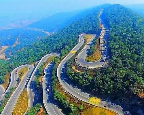
Godda is located at 24.83°N 87.22°E. It has an average elevation of 77 meters (252 ft). Godda came into existence on 25 May 1983 as the 55th district of undivided Bihar. After the bifurcation of Bihar into Jharkhand state on 15 November 2000, it was one of the 18 districts of Jharkhand. National Highway 133 (NH-133) passes through the city of Godda.
Overview
The map shows a hilly area in the Dumka district with the Rajmahal Hills running from the banks of the Ganges in the extreme north to the south beyond the area covered by the map. ‘Farakka’ is marked on the map and this is where the Farakka Barrage is located in West Bengal. The map shows the Rajmahal coalfield. The entire region is heavily rural, with only small pockets of urbanization.
Note: The full-screen map is interesting. All the places marks on the map link and you can easily go to another page of your choice. Enlarge the map to see what else is there – one finds railway links, many more road links, etc.
Economy
Agriculture is predominant in the region and rice, wheat and maize are the main crops grown here along with vegetables, linseed, and sugarcane. Fruits like Mango, Banana, Jackfruit and Ber grow in this region. Some small and medium-scale industries are also present in Godda.
Godda has witnessed industrialization in recent times and several major industrial projects have come up here. Jindal Steel & Powers came up with a thermal power plant of 1320 MW capacity at Tesubathan (Sunderpahari).
Adani Power or Adani Godda is setting up its 1600 MW thermal power plant at Godda and it will become India’s first power sector special economic zone.
Rajmahal Coal Mining Limited, a subsidiary of the Aditya Birla Group, operates the Eastern Coalfields mine at Mahagama. [8] ECL’s Lalmatiya Colliery is one of the oldest and largest mining projects in India. Eastern Coalfields also operates mines in Godda’s Sundarpahari and Boarijore blocks.
अर्थव्यवस्था
इस क्षेत्र में कृषि प्रमुख है और चावल, गेहूं और मक्का सब्जियों, अलसी और गन्ने के साथ यहां उगाई जाने वाली मुख्य फसलें हैं। इस क्षेत्र में आम, केला, कटहल, बेर जैसे फल उगाए जाते हैं। गोड्डा में कुछ छोटे और मध्यम स्तर के उद्योग भी मौजूद हैं।
गोड्डा ने हाल के दिनों में औद्योगीकरण देखा है और कई प्रमुख औद्योगिक परियोजनाएं यहां आई हैं। जिंदल स्टील एंड पॉवर्स ने तेसुबथान (सुंदरपहाड़ी) में 1320 मेगावाट क्षमता के थर्मल पावर प्लांट के साथ शुरुआत की।
अदानी पावर या अदानी गोड्डा अपना 1600 मेगावाट का थर्मल पावर प्लांट गोड्डा में स्थापित कर रहा है और यह भारत का पहला बिजली क्षेत्र का विशेष आर्थिक क्षेत्र बन जाएगा।
आदित्य बिड़ला समूह की सहायक कंपनी राजमहल कोल माइनिंग लिमिटेड महागामा में ईस्टर्न कोलफील्ड्स की खदान का संचालन करती है। [8] ईसीएल की लालमटिया कोलियरी भारत की सबसे पुरानी और सबसे बड़ी खनन परियोजनाओं में से एक है। ईस्टर्न कोलफील्ड्स गोड्डा के सुंदरपहाड़ी और बोआरीजोर ब्लॉक में भी खदानों का संचालन करती है।
Connectivity
Godda well connects by road and rail connectivity. Godda Railway Station has located approximately 4 km from the city center. Humsafar Express was the first train to leave from Godda Railway Station on 8th April 2021. This weekly train will connect Godda to New Delhi via Bhagalpur and Gaya. National Highway NH-133 passes through Godda.
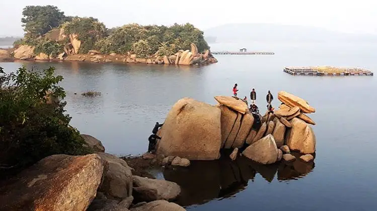
Places to Visit
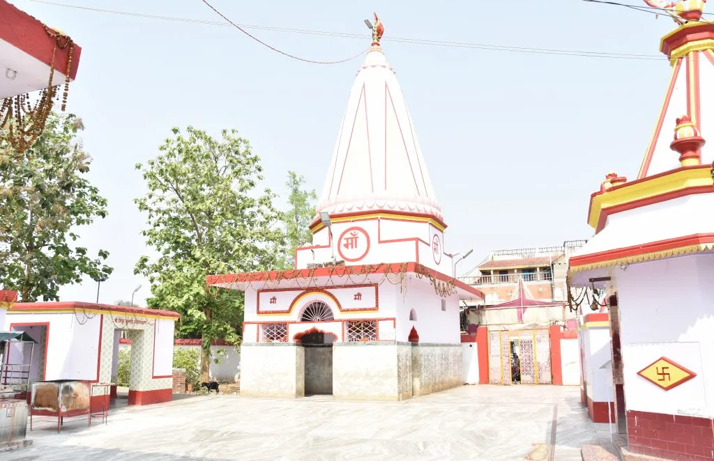
The Yogini Shaktipeeth at Pathargama is one of the Shakti Peethas of the Shaktism tradition in India. Here Sati’s thighs fell at the time of her death and Shiva carried her body while performing Tandav.
Basantarai, the place name after Raja Basantarai, the ruler of the area, and a large tank was built there by him. It is known to have miraculous powers and according to legend, no one is ever able to cross the tank from one end to the other. Fairs are always held on its banks for 15 days starting from the Chait Sankranti festival i.e. 14th April.
Sundar Dam is the biggest irrigation project build on the river Sundar near Rajabhitha village (Pathargama) and is a beautiful picnic spot for tourists.
Biodiversity Park Godda is a newly creates park here and has various herbs and trees. It is a new point of attraction among the local people and the shooting of Santali songs.
FAQs on Godda Jharkhand
What is Godda famous for?
Godda is mostly famous for the Rajmahal coal field in Lalmatia. It is an integral part of Jharkhand and is known for its hills and small forests. The mine here is an integral part of the ECL Coalfields and one of the largest mines in the whole of Asia
What is the old name of Godda?
Godda was a part of the undivided Santhal Parganas district till the 1981 census. Later a new district carves out from the old Godda subdivision of Santhal Pargana. The Santhal Parganas district carve out parts of Bhagalpur and Birbhum as a result of the Santhal rebellion of 1845–55.
When was Godda formed?
Godda came into existence on 25 May 1983 as the fiftieth district of undivided Bihar and became the 18th district of the state of Jharkhand coming into existence on 15 November 2000. It was a sub-division of Santhal before attaining the status of a district. Parganas District since 1855.
Dumka is urban or rural?
Most of the population, about 93% (about 12.3 lakhs) lives in the rural part and 7% (about 90 thousand) live in the urban part. The rural population density of Dumka district is 330 and the urban population density is 3309 persons per km2.
What is the capital of Godda?
It is located 297 KM west towards the State capital Ranchi. The population of Godda district is 1311382. It is the 12th largest district in the state by population.
Suggested Link:- National Scholarship Portal
@Ron