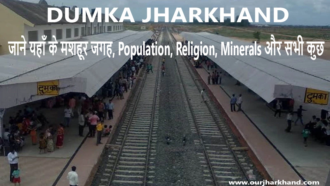
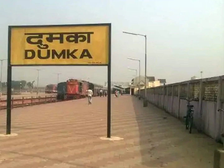
Dumka Jharkhand: Dumka, the headquarters of Dumka district and Santhal Parganas region, is a city in the state of Jharkhand, India. It was made the headquarters of the Santhal Pargana region, which was carved out of the Bhagalpur and Birbhum districts after the Santhal Hull of 1855.
In Hindi: दुमका, दुमका जिले और संथाल परगना क्षेत्र का मुख्यालय, भारत के झारखंड राज्य का एक शहर है। इसे संथाल परगना क्षेत्र का मुख्यालय बनाया गया था, जिसे 1855 के संथाल हल के बाद भागलपुर और बीरभूम जिलों से अलग कर बनाया गया था।
Also, Read- Netarhat Jharkhand, Origin और History, Chotanagpur की रानी (Netarghat) कैसे पहुँच सकते हैं?… Read More
Baba Basukinath Dham Temple located in Dumka district spreads the name of this district in the whole of Jharkhand and Bihar. Pilgrims who come to Deoghar must come here once. This district is a district located in the Jharkhand state of India. Filled with natural beauty covered with mountains, rivers, and forests, this district is counted among the oldest districts of Jharkhand. Dumka district comes under the Santhal Parganas division. It is also the headquarter of the Santhal Pargana Division. A total of 6 districts come under Santhal Pargana Division: Deoghar, Jamtara, Dumka, Pakur, Godda, and Sahibganj.
Naming
Two things are said about the naming of this district. During British rule, this area was a small town compared to Rampurhat and Bhagalpur. The first hypothesis is that the name of the Dumka district is derived from the Santhali word “Sumak” which means “small”. The meaning is “edge of the hills” or “boundary”.
When did the Dumka district become?
Before coming into existence as an independent district, this district used to be a part of the erstwhile Santhal Parganas district. On June 1, 1983, it was separated from the Santhal Parganas district and made an independent district.
The geographical location of the Dumka district
- Boundary
- In the north – the Godda district and Banka district of Bihar
- In the south – Jamtara district and Birbhum district of West Bengal
- East – the Pakur district
- In the west – Deoghar district
Height above sea level: Dumka district is situated at an altitude of about 472 feet (about 144 m) above sea level.
Area
The geographical area of the Dumka district is 3761 square kilometers.
Major Rivers: Mayurakshi River
Economy- Agriculture, Industry, and Products
The economy of this district is based on agriculture, minerals, industry, and tourism.
Agriculture (कृषि)
The major crops grown in this district are Paddy, Maize, Pulses, Oilseeds, Wheat Peas, etc. Vegetables are also cultivated here. Tomato, potato, jackfruit, spinach, brinjal, cauliflower, etc. are grown in the district. More than 30% of the land of this district is forest area. The forests of the district are full of medicinal plants and trees. Silk plantation is done in dense forests.
Minerals (खनिज पदार्थ)
Major minerals found in this district are: coal, china clay, granite, and stone (used in buildings, roads, pools, etc.)
Industry (उद्योग)
Talking about the industry, here building materials are available in abundance for building construction. Jharkhand ranks first in India in Tussar silk production. Dumka district calls the future silk city. Dumka is the largest Tusar silk-producing district in India. Cocoon is produced in almost all the blocks of the district. Maslia, Ranishwar, Shikaripada, Saraiyahat, Kathikund, and Gopikandar are the 6 major producing blocks of silk.
Sightseeing (पर्यटन)
This district is very important from the point of view of tourism. People from different states come here to see religious, historical, and archaeological sites.
Administrative Setup of Dumka District
Division: Santhal Parganas
For administrative convenience, this district has divides into 1 subdivision and 10 blocks.
Subdivision: There is only 1 subdivision under this district- Dumka.
- Block:
- This district is divided into 10 blocks: Dumka, Jama, Jarmundi, Saraiyahat, Ramgarh, Gopikandar, Kathikund, Shikaripada, Ranishwar, and Masaya.
- Number of Urban Bodies: 2, Basukinath and Dumka
- Number of Police Stations:14
- Total No. of Villages: 2925
- Number of Gram Panchayats: 206
Constituency
1 Lok Sabha constituency and 4 assembly constituencies come under this district.
Lok Sabha
There is only one Lok Sabha constituency under this district: Dumka.
Assembly
A total of 4 assembly constituencies come under this district: Dumka, Shikaripada, Jarmundi, and Jama.
Demography of Dumka District
- According to the official census of 2011, the demographics of Dumka district are as follows-
- Total population: 13.21 lakh
- Male: 6.68 Lakh
- Female: 6.52 Lakh
- Population growth (decadal): 19.42%
- Population Density (per sq km): 351
- Proportion to the population of Jharkhand: 4.01%
- Sex Ratio (Females per 1000 Males): 977
- Average Literacy: 61.02%
- Male Literacy: 72.96%
- Female Literacy: 48.82%
- Urban and rural population
- Urban Population: 6.82%
- Rural Population: 93.18%
- Major languages: Hindi and Santhali
Also, Read- Also, Read- Dhanbad Jharkhand, Environment, Socioeconomics, Populations, Religion, Economy, Transport… Read More
Dumka District Religion
2011 की आधिकारिक जनगणना के अनुसार, यह एक हिंदू बहुसंख्यक जिला है। जिले में हिंदुओं की जनसंख्या 79.06% है, जबकि मुसलमानों की जनसंख्या 8.09% है। अन्य धर्मों की बात करें तो जिले में ईसाई 6.54%, सिख 0.02%, बौद्ध 0.02%, जैन 0.01% और अन्य 5.95% हैं।
Places to visit in Dumka District
Baba Basukinath Dham
भगवान शिव को समर्पित यह प्रसिद्ध मंदिर जिला मुख्यालय से लगभग 24 किमी दूर उत्तर-पश्चिम में जरमुंडी प्रखंड में स्थित है। हिन्दुओं का यह पवित्र तीर्थ स्थल इस जिले का प्रमुख आकर्षण है। हर साल खासतौर पर सावन के महीने में देश-विदेश से लाखों की संख्या में श्रद्धालु यहां भगवान शिव की पूजा करने आते हैं। बाबा बासुकीनाथ नाथ धाम मंदिर देवघर में वैद्यनाथ धाम ज्योतिर्लिंग से लगभग 44 किलोमीटर की दूरी पर स्थित है। ऐसी मान्यता है कि बाबा बासुकीनाथ के दर्शन के बिना बाबा बैद्यनाथ धाम की यात्रा अधूरी है।
Baba Sumeshwar Nath
भगवान शिव को समर्पित यह विशाल और प्राचीन मंदिर दुमका जिला मुख्यालय से करीब 60 किलोमीटर दूर सरैयाहाट प्रखंड में स्थित है. महाशिवरात्रि के शुभ अवसर पर बड़ी संख्या में भक्त यहां भगवान शिव की पूजा अर्चना करने आते हैं।
Sukhjora Snake Temple
This famous temple is located in Sukhjora village near Nonihat, at a distance of about 10 km from Baba Basukinath Dham. There is a belief about this temple that by drinking the water of this temple, the poison of snakebite victims escalates.
Mayurakshi River
करीब 250 किलोमीटर लंबी यह नदी दुमका जिले की प्रमुख नदी है। इस नदी का उद्गम स्थल त्रिकुट पहाड़ी है जो देवघर से लगभग 16 किलोमीटर की दूरी पर स्थित है।
Maluti
झारखंड के इस जिले में स्थित एक छोटा सा गांव है मालुती। यह मंदिरों के गांव के रूप में प्रसिद्ध है। ऐतिहासिक एवं धार्मिक रूप से महत्वपूर्ण यह स्थान दुमका जिला मुख्यालय से लगभग 55 किलोमीटर दूर शिकारीपाड़ा प्रखंड में स्थित है. यहां 72 पुराने मंदिर हैं। मंदिरों की दीवारों पर हिंदू पौराणिक कथाओं, रामायण और महाभारत के दृश्यों को चित्रित किया गया है। कहा जाता है कि इन मंदिरों का निर्माण बज बसंत वंश के शासनकाल में हुआ था।
Also, Read- Bhulekh Jharkhand, Highlights of Jharbhumi, How to Che…Read More.
Tatloi
ततलोई जिला मुख्यालय से लगभग 15 किमी की दूरी पर स्थित गर्म पानी का प्राकृतिक झरना है। पहाड़ियों से घिरा, प्रकृति की गोद में बसा यह खूबसूरत स्थान एक लोकप्रिय पिकनिक स्थल है और पर्यटकों को अपनी ओर आकर्षित करता है।
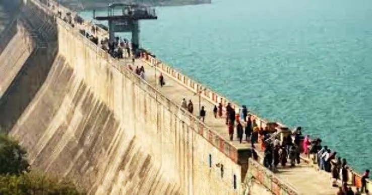
Massanjore Dam
कनाडा की मदद से मयूराक्षी नदी पर बना मसानजोर बांध दुमका से लगभग 31 किमी दक्षिण में स्थित है। पहाड़ियों से घिरा यह बेहद खूबसूरत स्थान दुमका जिले का एक लोकप्रिय पिकनिक स्थल और प्रसिद्ध पर्यटन स्थल है।
Some Interesting facts about Dumka District:
- जनसंख्या की दृष्टि से झारखंड का 11वां बड़ा जिला है.
- क्षेत्रफल की दृष्टि से झारखंड का 9वां बड़ा जिला है.
- जनसंख्या घनत्व के मामले में झारखंड में 15वां स्थान है.
- लैंगिक अनुपात के मामले में झारखंड में 7 वां स्थान है.
- मसलिया प्रखंड के अंतर्गत आने वाला नोनीहाट इस जिले का सबसे बड़ी आबादी वाला गांव है.
- सबसे ज्यादा गांव वाला प्रखंड: जरमुंडी (512)
- सबसे कम गांव वाला प्रखंड : सरैयाहाट (129)
- क्षेत्रफल की दृष्टि से जिले का सबसे बड़ा गांव:
- मसलिया प्रखंड के अंतर्गत आने वाला गांव अमगाछी पहाड़ ( क्षेत्रफल -लगभग 1375 हेक्टेयर).
- क्षेत्रफल की दृष्टि से जिले का सबसे छोटा गांव:
- सरैयाहाट प्रखंड के अंतर्गत आने वाला गांव अराजी सुगी (क्षेत्रफल-0.5 हेक्टेयर)
FAQs on Dumka Jharkhand
दुमका क्यों प्रसिद्ध है?
दुमका अपने समृद्ध और विविध मंदिरों और मंदिरों के साथ एक उल्लेखनीय स्थान है। यह समृद्ध परंपरा, विरासत और ऐतिहासिक महत्व का स्थान है।
Dumka में कितने मंदिर हैं?
मलूटी झारखण्ड राज्य के दुमका जिले में शिकारीपाड़ा के निकट एक छोटा सा कस्बा है। यहाँ ७२ पुराने मंदिर हैं जो बज बसन्त वंश के राज्यकाल में बने थे। इन मन्दिरों में रामायण तथा महाभारत और अन्य हिन्दू ग्रन्थों की विविध कथाओं के दृष्यों का चित्रण है।
दुमका ग्रामीण है या शहरी?
अधिकांश जनसंख्या, लगभग 93% (लगभग 12.3 लाख) ग्रामीण भाग में रहती है और 7% (लगभग 90 हजार) जनसंख्या शहरी भाग में रहती है । दुमका जिले का ग्रामीण जनसंख्या घनत्व 330 है और शहरी जनसंख्या घनत्व 3309 व्यक्ति प्रति किमी 2 है।
संथाल परगना में सबसे बड़ा जिला कौन सा है?
क्षेत्रफल के हिसाब से पश्चिमी सिंहभूम जिला झारखंड राज्य का सबसे बड़ा जिला है। जिले का कुल क्षेत्रफल 10,863 km2 है। इस जिले का कुल आबादी 15.02 लाख है। पश्चिमी सिंहभूम झारखंड के सबसे पुराने जिलों में से एक है।
दुमका में कौन सा मंदिर स्थित है?
नाग मंदिर दुमका में बाबा शिवपहाड़ की पहाड़ी के शीर्ष पर स्थित एक भव्य एवं प्राचिन मंदिर है। दुमका जिले में स्थित शिवपहाड़ स्थानिय लोगो के बीच बहुत प्रसिद्ध है यहाँ अनेको भगवान के छोटे-छोटे मंदिर स्थित है। परन्तु मुख्य मंदिर भगवान शिव के लिए समर्पित है।
Suggested Link:- My Business Mart
@Ron