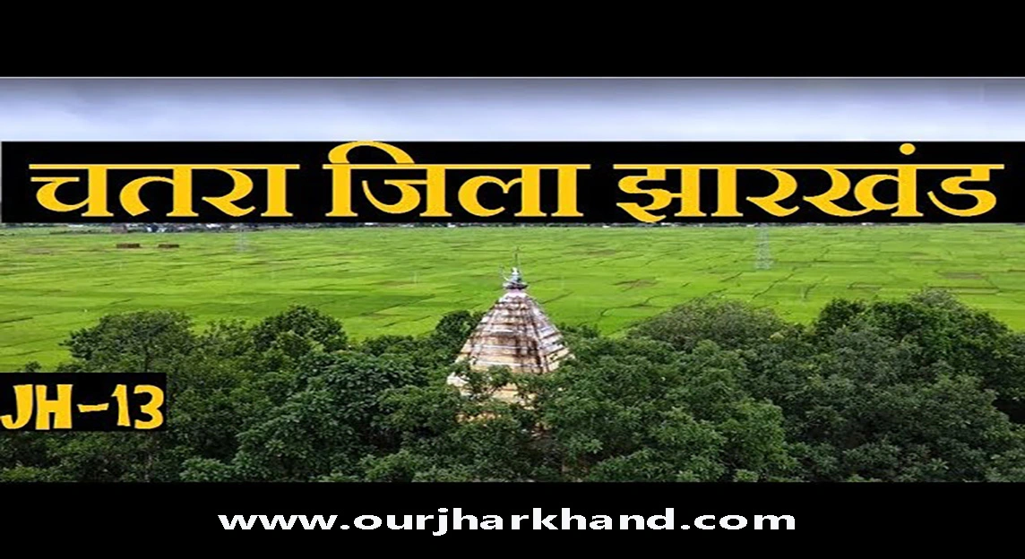
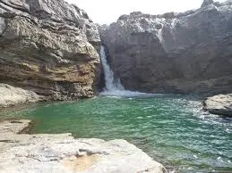
Chatra Jharkhand: Chatra district is spread over an area of 3706 sq km, situated between 23°38’34” N and 24°27’48” N latitude and 84°26’50” E and longitude 85°23’41” east with its district headquarters at Chatra. The average height of Chatra is 2012 ft above sea level. Chatra district is situated on the Hazaribagh plateau.
It is bounded by the Gaya district of Bihar state on the north, Palamu district on the west, surrounded by Latehar, Ranchi, and Hazaribagh districts in the south, and Koderma and Hazaribagh districts in the east. Chatra forest is home to a variety of medicinal plants, Kendu leaves, bamboo, sal, teak, other wood species, and carnivorous and herbivorous wild animals. Filled with a wide range of animals. The district has a wildlife sanctuary also known as Lolang Wildlife Sanctuary and the major animals found are tiger, leopard, bear, nilgai, sambar, peacock, wild boar, and deer. as well as a variety of snakes and birds.
In Hindi:
चतरा जिला 3706 वर्ग किमी के क्षेत्र में फैला हुआ है, जो 23°38’34” N और 24°27’48” N अक्षांश और 84°26’50” E और देशांतर 85°23’41” पूर्व के बीच अपने जिले के साथ स्थित है। मुख्यालय चतरा। चतरा की समुद्र तल से औसत ऊंचाई 2012 फीट है। चतरा जिला हजारीबाग पठार पर स्थित है।
यह उत्तर में बिहार राज्य के गया जिले, पश्चिम में पलामू जिले, दक्षिण में लातेहार, रांची और हजारीबाग जिलों और पूर्व में कोडरमा और हजारीबाग जिलों से घिरा हुआ है। चतरा वन विभिन्न प्रकार के औषधीय पौधों, केंदू के पत्ते, बांस, साल, सागौन, अन्य लकड़ी की प्रजातियों और मांसाहारी और शाकाहारी जंगली जानवरों का घर है। जानवरों की एक विस्तृत श्रृंखला से भरा हुआ। जिले में एक वन्यजीव अभयारण्य है जिसे लोलंग वन्यजीव अभयारण्य के रूप में भी जाना जाता है और पाए जाने वाले प्रमुख जानवर बाघ, तेंदुआ, भालू, नीलगाय, सांभर, मोर, जंगली सूअर और हिरण हैं। साथ ही तरह-तरह के सांप और पक्षी।
Culture and Heritage
Religion and Culture
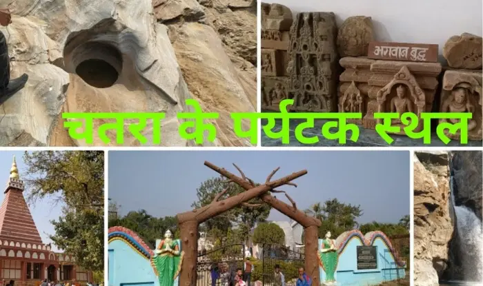
Chatra has been a place of religious tolerance since time immemorial. It is mainly famous for the “Shakti” cult. The famous seat of this sect is found in Hunterganj and Itkhori block. Some Muslim temples are located in Pratappur Block and Chatra Sadar.
Kauleshwari: Chatra Jharkhand
Kauleshwari Devi Temple is situated on top of Kolhua hill at an altitude of 1575′ in Hunterganj block. It includes some ruined temples and historical monuments. It is a place of pilgrimage for Hindus, Buddhists, and Jain Tirthankaras. Its antiquity dates back to the 10th century BC. Here the idols of Gautama Buddha in meditation posture are also carved on the rock from the time of Harshavardhana, who was an ardent follower of the Mahayana school of Buddhism. There is a temple of Maa Kali known as Kauleshwari Devi or Kuleshwari Devi, who is the revered goddess of the Kol community. People associate this place with the epic era i.e. Ramayana and Mahabharata. On Basant Panchami and Ram Navami, a large number of pilgrims come to the top of the hill for worship. It is an attractive and lovely picnic spot with a very beautiful trek of a one-hour duration.
Bhadrakali: Chatra Jharkhand
Itkhori block headquarter has a famous temple of Bhadrakali where a pleasant amalgamation of Hindu, Jain, and Buddhist deities can be seen. The Buddha deity Tara can be seen here in a black stone image. It also has an inscription from the time of King Mahendra Pal Dev. Dr. Grierson in his Notes on Gaya District (p.3,4) describes the Buddhist Stupa in the Bhadrakali complex of Itkhori. A pair of footprints can also be seen. It is associated with Sheetal Nath, the 10th Tirthankara of Jainism. It is also associated with the 19th Tirthankara Mallinath and 23rd Tirthankara Parshvanath. Hindus worship the goddess Kali as Bhadrakali. The whole region is full of historical and cultural heritage.
Itkhori block is also famous for the image of the goddess Bhagwati. Here Goddess Kali is worshiped in the form of Jagdamba. People come here to perform sacrifice and Mundan rites. It has natural beauty and is a very good picnic spot.
Barura Sharif: Chatra Jharkhand
Pratappur has a temple of Data Amir Ali Shah at Barura Sharif on the banks of Sat Bahini river, it is said that the Sufi saint came here in the late 18th century. Hindus and Muslims alike come here to pay respect to the revered saint at his tomb. People suffering from evil spirits come here in large numbers and get their treatment done.
Rabda Sharif: Chatra Jharkhand
In Rabda Sharif of Pratappur, there is a Mazar (shrine) of Data Faham Khayal Shah who was a contemporary of Amir Ali Shah, the donor of Barura Sharif. Here the annual fair of saints is celebrated with pomp.
Shahi Masjid of Chatra
The district headquarters at Awwal Mohalla has a royal mosque that was constructed after 1660 AD when Aurangzeb’s Mughal governor Daud Khan conquered Kothi and Kunda. The mosque had a Tehkhana and Toshakhana which have now been closed and the mosque has been rebuilt in a modern style.
Accompaniment: Chatra Jharkhand
Chatra’s Gudri Bazar locality has a Sangat of the Udasi sect of Sikh doctrine where there is an old script of the holy Guru Granth Sahib. It is worshiped at this place and held in high esteem by Sikhs and Hindus as well.
Thus, Chatra is a symbol of communal harmony where Hindus, Muslims, and Sikhs live in peace and harmony.
Language
There is no distinct and recognized language in this district. The commonly spoken dialects are Magahi, Nagpuri, and Khortha. But even these dialects are not in pure form; Rather in a mixed form. Generally, people understand, speak and write Hindi and Urdu. In daily matters, people use local dialects but in official communication, they use either Hindi or Urdu.
ST population is not very significant in the district but they use Sadri or Nubandari (tribal language) among themselves.
Festivals
The important festivals of the Hindus are Holi, Diwali, Dussehra, and Ram Navami. Other festivals like Basant Panchami, Chhath, Jthya Bhaiya Dooj, Teej, Jitiya, etc. are also celebrated in this district. The important festivals of Muslim communities are Eid-ul-Fitr, Bakrid, Muharram, and Shabe-Barat. The typical festivals of the tribes are Karma, Manda, Sarhul, Jani Shikar, etc. Non-tribals also participate in the Karma festival.
Art and Craft
There is nothing particularly worth mentioning about arts and crafts in this district, but handicrafts such as Tokri (basket), Beeri, Pattal (plate of leaves), and pottery (such as pitcher, cherry, jar, etc.) ), etc are to be made. source of livelihood.
Music and Dance
Folk music is popular in the rural areas of the district. Also, it is usually presents at important festivals, marriages, and other occasions. However tribal dances are rhythmic and are performed on the eve of festivals, marriages, and other occasions.
Administrative Setup
Chatra district is
- 2 subdivisions
- 12 block
- 152 Panchayats and 1472 villages.
It has 12 development blocks;
- Hunterganj
- Pratappur
- Kunda
- Chatra
- Lawalaung
- snack food
- Giddhaur
- Pathalgada
- Simaria
- Tandawa
- Kanha Chatti
- Mayur Hand
Demographics
- Chatra district with a population of about 10.4 lakhs is the 10th least populous district of Jharkhand. Total geographical area of Chatra
- The district occupies 3718 km2 and is the 10th largest district by area in the state. The population density of the district is 280 persons per km2.
- It is home to about 10.4 lakh people, out of them about 5.3 lacks (51%) are males and about 5.1 lacks (49%) are females. Caste-wise, 63%
- The entire population is from the general caste, 33% are from the scheduled caste and 4% are from the scheduled tribe.
- Most of the population lives in rural areas, comprising about 94% (about 9.8 lacks) and 6% (about 0.63 lacks) of the population.
- Live in the urban areas of the Chatra district. The rural population density is 266 and the urban population density is 1931 persons per km2.
- The district has grown by 31.8% in the last 10 years. According to the 2011 census, there are 953 females per 1000 males in the district. sex ratio in general caste is 942, SC is 972 and ST is 969.
जनसांख्यिकी
- लगभग 10.4 लाख की आबादी वाला चतरा जिला झारखंड का 10वां सबसे कम आबादी वाला जिला है। चतरा का कुल भौगोलिक क्षेत्रफल
- जिले का क्षेत्रफल 3718 किमी2 है और यह राज्य में क्षेत्रफल के हिसाब से 10वां सबसे बड़ा जिला है। जिले का जनसंख्या घनत्व 280 व्यक्ति प्रति किमी 2 है।
- यह लगभग 10.4 लाख लोगों का घर है, उनमें से लगभग 5.3 लाख (51%) पुरुष हैं और लगभग 5.1 लाख (49%) महिलाएं हैं। जातिवार, 63%
- पूरी आबादी सामान्य जाति से है, 33% अनुसूचित जाति से हैं और 4% अनुसूचित जनजाति से हैं।
- अधिकांश आबादी ग्रामीण क्षेत्रों में रहती है, जिसमें लगभग 94% (लगभग 9.8 लाख) और 6% (लगभग 0.63 लाख) आबादी शामिल है।
- चतरा जिले के शहरी क्षेत्रों में रहते हैं। ग्रामीण जनसंख्या घनत्व 266 है और शहरी जनसंख्या घनत्व 1931 व्यक्ति प्रति किमी 2 है।
- पिछले 10 वर्षों में जिले में 31.8% की वृद्धि हुई है। 2011 की जनगणना के अनुसार जिले में प्रति 1000 पुरुषों पर 953 महिलाएं हैं। सामान्य रूप से लिंग अनुपात
- जाति 942, एससी 972 और एसटी 969 है।
Topography and Climate
- A major physical feature on the major part of the district’s rolling topography is dotted with isolated inselbergs.
- Except for Borijor and Sunderpahari blocks. an important part
- Boarijor and Sunderpahari blocks are under a forest area.
- Then the height of the land surface increases from west to east.
- Also, the major hills are confined to the eastern part of the district.
- Gandeshwari Pahar (238.41m AMSL) and Kesagari Pahar
- (268.29m AMSL) while the western part of the district is isolated
- The hills are in the form of Inselberg and other small hills.
- The soil is mostly acidic, reddish-yellow, lightly textured, and highly
- Permeable with poor water holding capacity.
- Also, the southern part of the district is covered by granite igneous rock formations of the Achaean age. they are like this
- Intrusions are made by large batholiths and parent rocks.
- The district falls in the rain shadow area of the Santhal Parganas plateau. The average annual rainfall is 1250 mm and the average
- The number of rainy days is 59. Even this meager rainfall is uncertain
- which combined with the long gap forces the district to suffer dry.
Drainage
The main rivers of the district are Barki, Chako, Damodar, and Garhi. Also, the general slope of the district is from north to south. The general drainage trend is from southeast to northwest structural features especially the leaves and joints make a deep impression. Also, over drainage and control the drainage pattern of the district.
FAQs on Chatra Jharkhand
Why is Chatra famous?
Chatra has been a place of religious tolerance since time immemorial. It is mainly famous for the “Shakti” cult. Also, the famous seat of this cult is found in Hunterganj and Itkhori blocks. Although some Muslim shrines are located in Pratappur Block and Chatra Sadar.
चतरा क्यों प्रसिद्ध है?
चतरा अनादि काल से धार्मिक सहिष्णुता का स्थान रहा है। यह मुख्य रूप से “शक्ति” पंथ के लिए प्रसिद्ध है। इस पंथ की प्रसिद्ध सीट हंटरगंज और इटखोरी प्रखंडों में मिलती है। कुछ मुस्लिम तीर्थ प्रतापपुर ब्लॉक और चतरा सदर में स्थित हैं।
Is Chatra a Naxalite area?
Chatra Police has made several significant arrests of Maoist personnel as well as seized a number of arms and ammunition along with lethal explosive material and equipment. Chatra Police’s success against Naxalite organizations has helped in limiting Naxalite violence to a great extent.
क्या चतरा नक्सली इलाका है?
चतरा पुलिस ने माओवादी कर्मियों की कई महत्वपूर्ण गिरफ्तारियां की हैं और साथ ही घातक विस्फोटक सामग्री और उपकरणों के साथ कई हथियार और गोला-बारूद भी बरामद किए हैं। नक्सली संगठनों के खिलाफ चतरा पुलिस की सफलता से नक्सली हिंसा को काफी हद तक सीमित करने में मदद मिली है।
Which language spoken in the Chatra district?
As of the 2011 Census of India, 39.71% of the population in the district spoke Khortha, 39.21% Hindi, 12.47% Magahi, 5.47% Urdu, and 1.72% Kurukh.
चतरा जिले में कौन सी भाषा बोली जाती है?
भारत की 2011 की जनगणना के अनुसार, जिले में 39.71% आबादी खोरथा, 39.21% हिंदी, 12.47% मगही, 5.47% उर्दू और 1.72% कुरुख बोलती है।
What is the religion of Chatra?
Hinduism practice by 86.60% of the population of Chatra. In Chatra State, Muslims form a minority of 11.19% of the total population.
चतरा का धर्म क्या है?
चतरा की 86.60% आबादी द्वारा हिंदू धर्म का अभ्यास किया जाता है। चतरा राज्य में, मुसलमान कुल आबादी का 11.19% अल्पसंख्यक हैं।
What is the literacy rate of Chatra?
The child population comprises 18.90% of the total rural population of the Chatra district. Also, the literacy rate in rural areas of the Chatra district is 58.78% as per 2011 census data.
चतरा की साक्षरता दर कितनी है?
बाल आबादी में चतरा जिले की कुल ग्रामीण आबादी का 18.90% शामिल है। 2011 की जनगणना के आंकड़ों के अनुसार चतरा जिले के ग्रामीण क्षेत्रों में साक्षरता दर 58.78% है।
Chatra is urban or rural?
Also, the total area of the district is 3,718 km², 33 km² is urban and 3685 km² is rural. Also, out of the total population of Chatra, 1,157,604 are in the district, 62,954 are in an urban area and 979,932 are in rural areas.
चतरा शहरी है या ग्रामीण?
जिले का कुल क्षेत्रफल 3,718 किमी² है, 33 किमी² शहरी है और 3685 किमी² ग्रामीण है। चतरा की कुल जनसंख्या में से 1,157,604 जिले में, 62,954 शहरी क्षेत्र में और 979,932 ग्रामीण क्षेत्रों में हैं।
Suggested Link:- www.digitalindiagov.in
@Ron